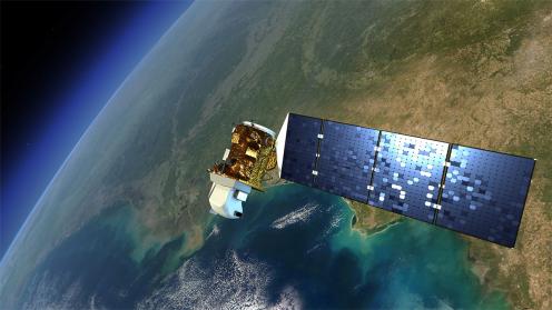
On Thursday, the Seventeenth Plenary Session of the Group on Earth Observations (GEO-17) focused on the use of Earth observations data to bridge the digital divide. GEO members presented examples of projects and initiatives underway around the world to enable full and open access to Earth observation data, and promote policy development and informed decision making.
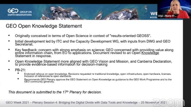
The GEO plenary also adopted the Statement on Open Knowledge, which emphasizes not only the concept of open science, but also of open access, citizen and participatory science, open data, software, hardware, and diversity of knowledge and overarching goals of open knowledge.
During the plenary, Jesus San Miguel-Ayanz, European Commission Joint Research Centre, discussed the application of the Global Wildfire Information System (GWIS) for monitoring and tracking wildfires. Omar Seidu, Ghana Statistical Service, described the Digital Earth Africa programme, which, he said, supports the realization of Agenda 2063: The Africa We Want, by bridging the data gap in Africa.
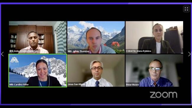
Carolina Adler, Executive Director, Mountain Research Initiative, and James Thornton, Mountain Research Initiative, highlighted the GEO Mountains initiative. They gave examples of outputs, such as the Inventory of In Situ Observational Infrastructure, which is an online inventory and web-mapping application. Krishnachandran Balakrishnan, Indian Institute for Human Settlements, discussed the India Data Cube, project which aims to generate land cover, population, and development indicator maps at sufficient spatial and temporal resolution to meet the needs of policymakers.
The session on “Nature-based Solutions (NbS)” put a spotlight on GEO’s work on NbS to address societal challenges and mitigate ongoing environmental crises. Elizabeth Maruma Mrema, Convention on Biological Diversity (CBD) Executive Secretary, emphasized the need to apply Earth observations to inform NbS and help tackle the interconnected crises of climate change and biodiversity loss. She highlighted opportunities for the GEO community to contribute to the discussions on the post-2020 global biodiversity framework, as providers of high-quality geospatial data required to monitor the framework’s targets and goals.
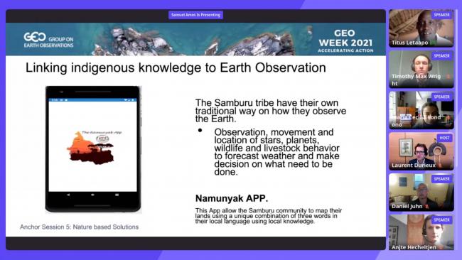
Titus Letaapo, Co-Founder, GEO Indigenous Alliance, and Managing Director, Sarara Foundation, reported on his organization’s work in the rangeland communities of northern Kenya, to revive practices, such as rotational grazing, which allows rejuvenation of pastures, tree planting, and reseeding of grasslands.
The GEO Week 2021 Youth Track also continued, and featured a cross-regional dialogue between Europe, the Commonwealth of Independent States and Asia-Oceania. In a keynote address, Yan Liu, Chinese Academy of Sciences, shared her experience as a young scholar working with GEO. She said working with experienced China GEO researchers enabled her to refocus her own research questions.
During the open discussion moderator Mikhail Fernandes, United Nations Environment Programme (UNEP), urged youth to utilize UNEP’s resources including training opportunities for youth.
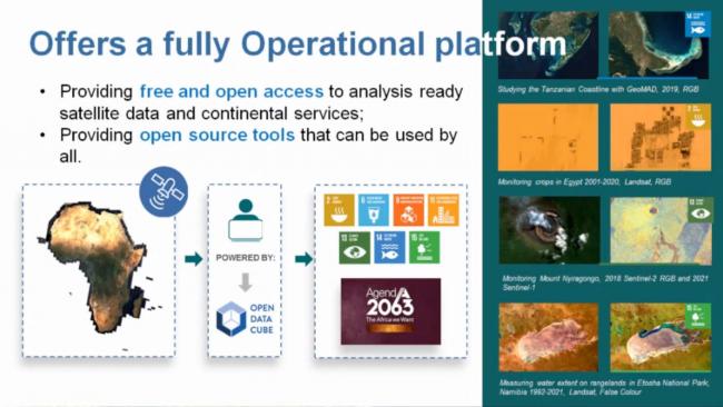
The side event on “Pathways to Impact in Africa” highlighted the vital role of open, operational platforms for Earth observations data and showcased the Digital Earth Africa and Africa GeoPortal platforms. Adam Lewis, Digital Earth Africa, described the platform as one that uses Earth observations to provide analysis-ready data to support policy and investment decisions. He explained it provides access to free and open data sets, and open-source tools that can be used by all to support achievement of the Sustainable Development Goals and other global policy agendas.
Pauline Okeyo, Esri, described Africa GeoPortal as a platform that provides geospatial data, tools for interacting with the data, and infrastructure for disseminating the data and content across Africa.
Other side events focused on determining and communicating the value of Earth observations, bringing together scientists, economists, policymakers and communicators.
To receive free coverage of global environmental events delivered to your inbox, subscribe to the ENB Update newsletter.
Selected Images
A slide from the presentation by Joseph Tuyishimire, Digital Earth Africa
Lilit Sahakyan, Center for Ecological-Nooshpere Studies

Sandra Delali Kemeh, GEO Secretariat
A slide from the presentation by Nuraini Rahma Hanifa

Nuraini Rahma Hanifa, U-INSPIRE Alliance
Alena Rybkina, GEO Data Working Group Co-Chair
GEO Lead Co-Chair for 2021, Joanna Drake, European Commission
A slide from the presentation by Mercury Fox, Founding Director, Center of Excellence in Data for Society (CODATA)

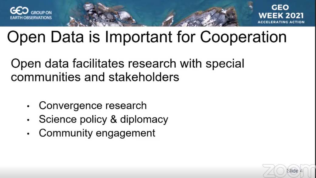
A slide from the presentation by Jesus San Miguel-Ayanz, European Commission Joint Research Centre
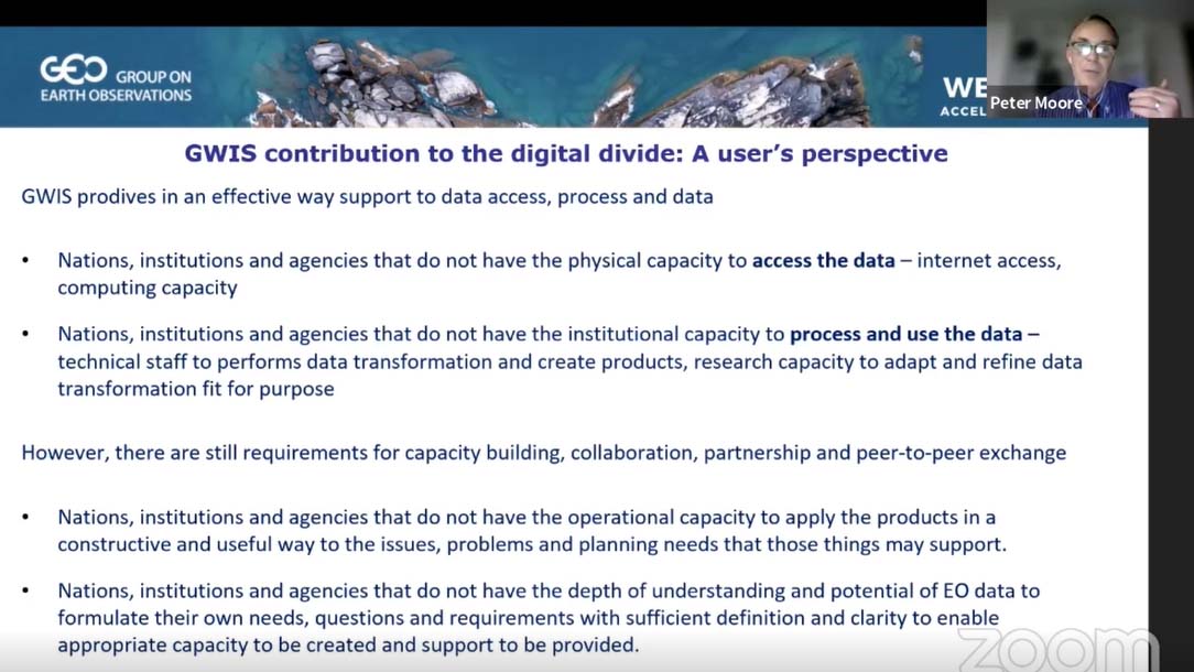
A slide from the presentation made by Peter Moore, GWIS
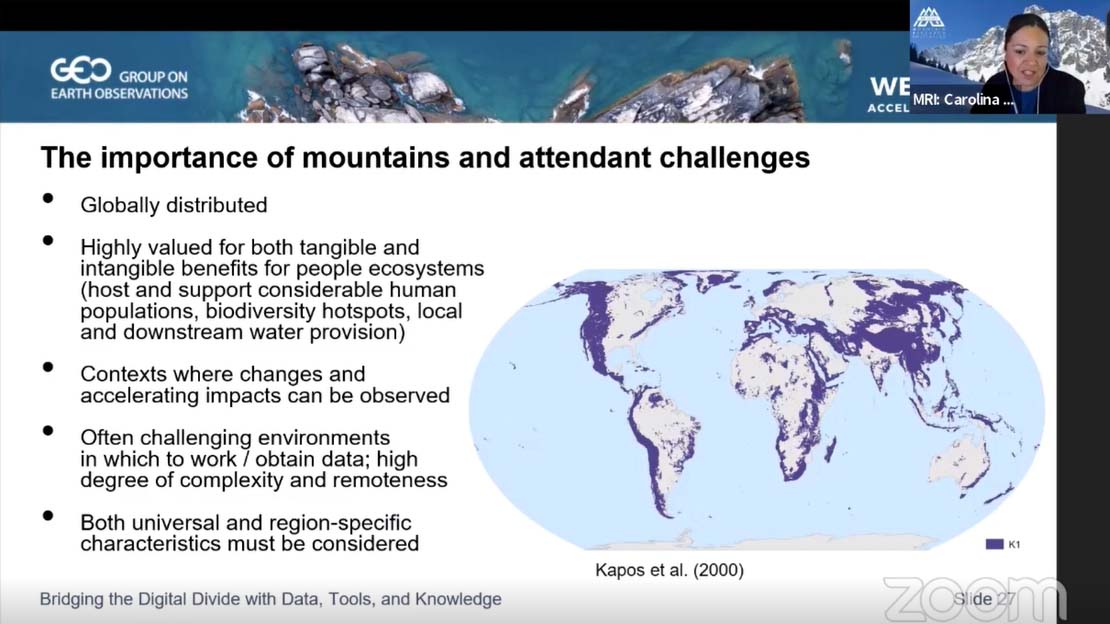
A slide from the presentation by Carolina Adler, Executive Director, Mountain Research Initiative
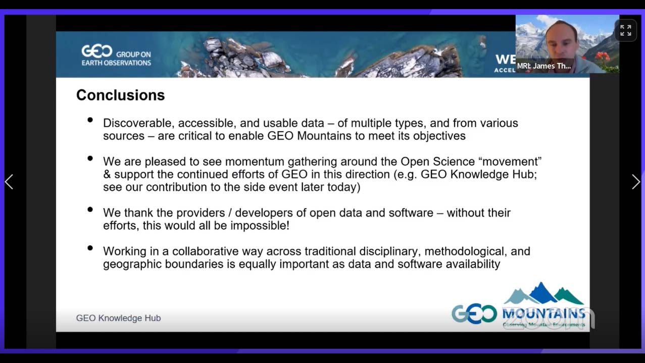
A slide from the presentation by James Thornton, Mountain Research Initiative
Marie-Francoise Voidrot, Europe Director, Innovation Program, Open Geospatial Consortium
Daniel Juhn, Conservation International
Jillian Campbell, CBD Secretariat

María Cecilia Londoño, Instituto Humboldt, Colombia

A slide from the presentation by María Cecilia Londoño

A slide from the presentation by Antje Hecheltjen
Antje Hecheltjen, Deutsche Gesellschaft für Internationale Zusammenarbeit GmbH
Timothy Max Wright, Moore Center for Science, Conservation International
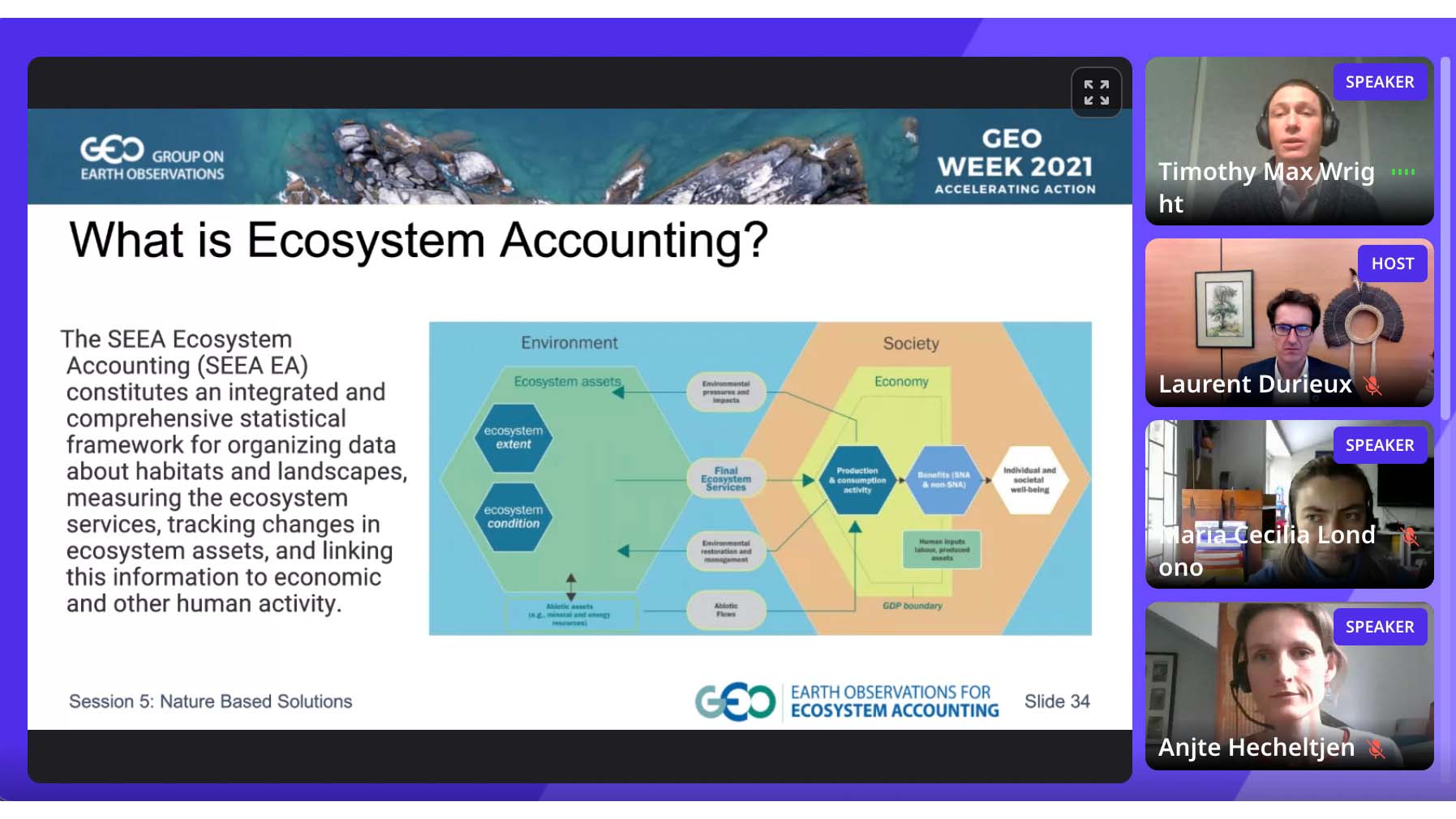
A slide from the presentation by Timothy Max Wright